
Awarded 2023 Best Of Greeley ‘Aerial Photographer’
Drone and Videography Services
My passion for film, photography and flight have blended into Elevation Aerial Photography and Drone Services. I fly drones selected from my on site fleet in order to meet the needs of a variety of clients. From music videos and film studios to agriculture and construction monitoring I provide bespoke imaging services. Elevation can provide complete video services including aerial, cinema camera, original sound and music, editing and lighting for marketing and narrative work.
Photography services range from technical to aesthetic for inspection as well as marketing needs. Real Estate, orthomosaics, event photography, corporate portraits, senior pictures, and products.
Please inquire about how I can help you reach your vision.
Our Services
– Fully Licensed and Insured –

Real Estate
We offer full-service real estate photography with VR, drone, and 3d exterior modeling available. Increase your sales with modern, artistic and high-quality video and imagery.
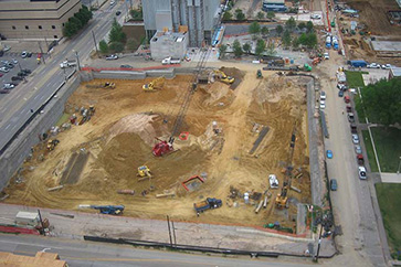
Mapping
Drones allow a for the mapping of almost any type of terrain, from construction sites to farms. Using aerial footage to create maps is faster, easier, and safer than most traditional methods.

Videography
Elevation uses only stable, smooth drone platforms and high-resolution cameras to ensure that all of our captured images and video are the highest quality possible.
Volumetrics
Drone maps enable easy and cost-effective access to accurate volumetric analysis. Our drones provide a faster method of measurement while maintaining the accuracy of more traditional methods.
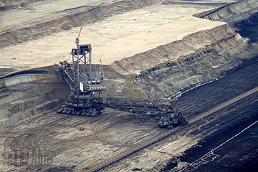
Inspection
The experts at Elevation can help you conduct property inspections much faster than traditional ground-based inspection methods. Our drones provide a safe and easy way to quickly monitor a wide area.

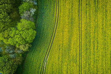
Agriculture
The number of farmers adopting the use of drones to help with tasks on their farms is growing rapidly. Drones offer a low-cost aerial camera platform that enables farmers to monitor their crops faster and easier than ever before.
Latest Current Project
– Horse Palace 21-
Client Missions Flown
Hours of Flight Time
Miles Flown
test
Days Without Incident
Client Testimonials
Follow us on Instagram
Have Questions? We Have Answers!
Our Service Locations Include: Fort Collins, Loveland, Windsor, Wellington, Norfolk, Greely, Briggsdale, Longmont, Hudson, and more Northeastern Colorado locations! Don't see your area? Get in touch with us today. We are always open to travelling to you.
